Kenya Maps and Orientation
(Kenya, KE, East Africa)
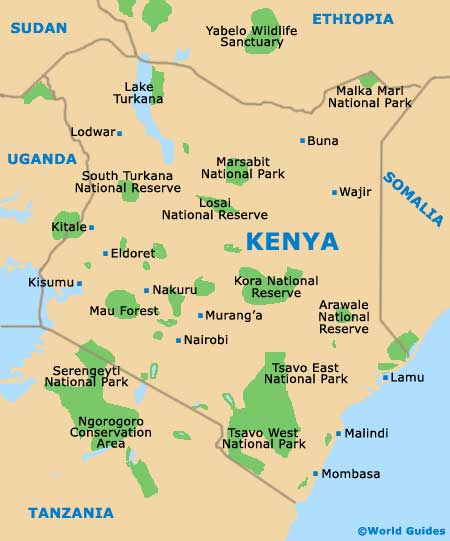
The 47th-biggest country in the world and boasting a population now exceeding 35 million, Kenya is bounded on its south-easterly side by the Indian Ocean, where there are a number of spreading mangrove swamps and beach resorts. Inland Kenya tends to consist of broad plains and spreading areas of hills, with the central and westerly regions being home to the Great Rift Valley and a number of mountains, such as both Mount Elgon and Mount Kenya.
The Kakamega Forest dominates much of western Kenya and lies to the north-west of the capital city of
Nairobi, where it is believed to be an ancient remnant of the famous Guineo-Congolian rainforest. Considerably larger is the Mau Forest, which occupies much of the Rift Valley and remains the biggest forest in East Africa.
Maps and Orientation of the Country
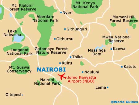
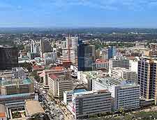
Those visiting Nairobi will find that the city centre is relatively compact, with this area edging the Haile Selassie Avenue, the Tom Mboya Street, the Uhuru Highway and the University Way. The centre is divided by Kenyatta Avenue, with many hotels being situated directly north of this stretch, while the suburbs of Karen and Langata are based to the south. Apart from Nairobi, other notable Kenyan cities include Eldoret, Embu, Garissa, Kisumu, Lamu, Lodwar, Meru, Mombasa, Nakuru and Nyeri.
Kenya borders the African countries of
Ethiopia, Somalia, Sudan, Tanzania and Uganada as follows.
- Ethiopia - north
- Somalia - east
- Sudan - north-west
- Tanzania - south
- Uganada - west
Continent Map of Africa

Map of Kenya
Map of Nairobi